


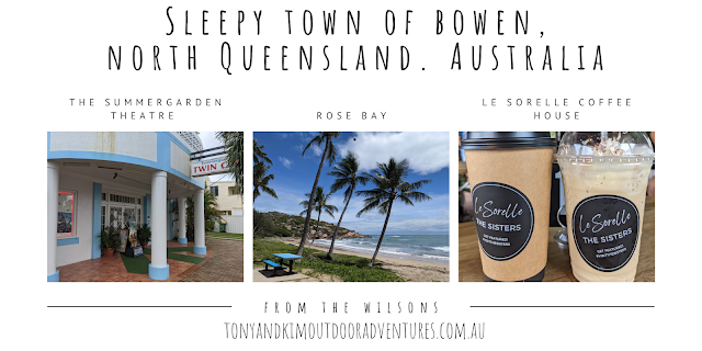
POVERTY POINT, COOLOOLA NATIONAL PARK. QLD
One of our secret campsites is Poverty Point in the Cooloola National Park. The Cooloola National Park is an incredible diversity of landscapes, stretching from the North Shore of the Noosa River, through open wallum heathland, to mangroves along Tin Can Bay. There are tropical rainforests, crystal clear lakes and mammoth coloured sand dunes, including the Carlo Sandblow. There are stunning beaches framed by high dunes, wildflowers, woodlands, Blackbutt forest, tranquil lakes, waterways and rainforest.

You’ll require vehicle permits when travelling within the Cooloola National Park. Those permits extend travelling north of the Noosa River to Middle Rocks, south-east of Rainbow Beach. Also travelling along the Freshwater track between Bymien and the beach, the Pettigrew Road, eastern and western firebreaks (Kings Bore Circuit) and the Leisha track


.
A Saturday morning, no so long ago Kim and I packed the Nissan Navara and headed north. First stop was the Eumundi Markets, which were interesting; Kim picked up a dress, a long dress as in down to her toes. She has always thought that long “maxi” dresses look weird and never tried one on. This one didn't look too bad at all. It also means, I think that she has more dresses than I do jeans or shorts. Once we were done with the markets we headed north again to Gympie and onto Tin Can Bay rd, which lead us to our first destination of Seary’s Creek for lunch and a paddle.


Seary’s Creek is a most wonderful place with a decent creek which flows out of a swamp. They have put in a lot of board walks and the two swimming holes where you can float and swim from one hole to the other. On a body board, you just float down, which is very pleasant. Both pools have tame yabbies. The yabbies come and nibble and tickle toes if you stand still. Then we drove into Poverty Point, which is a campsite at the southern end of Tin Can Bay. The road in is loose to packed sand, and a 4wd is required to reach the campsites. There were a few long stretches of deep sand, but the Blue Smurf handled it with ease without airing the tyres down. We camped about 10m from the sand and our fire was just on the bank above the sand.

Poverty Point is a lovely little sandy beach and when the tide goes out it is sand flats rather than the expected mud flats. This little-known spot on the southern shores of Tin Can Bay was developed by the logging industry around 1873 as a despatch point for the timber trade.
Logs were brought to Poverty Point via light rail and, later, trucks to be rafted up and floated to the Dundathu timber mill in Maryborough. We unpacked and setup camp and started a fire and tried our hand at a little fishing at sunset.


The next day we headed to the town of Tin Can Bay. Where is Tin Can Bay you might be asking? And you might be forgiven for not knowing prior to reading this blog. However you absolutely have no idea what you are missing out on by never being there! The funny part is that you have probably driven right past Tin Can Bay on many occasions, yet not known it was nestled just off the Bruce Highway in Queensland just north of Noosa.
It is a very sleepy little coastal village and home to some of the most stunning scenery and fantastic ocean passage. If you are coming by boat then this is a fantastic spot to anchor down for a few days, as it is very sheltered. The beautiful harbour area is dotted with an array of yachts, fishing boats and houseboats all parked up and relaxing. Tin Can Bay offers sensational fishing, great watersports and an awesome doorway to explore the ocean.


But it is something quite out of the ordinary, which makes Tin Can Bay a stand out destination. It is the wild dolphin feeding which happens every single day of the year. Now this is no normal dolphin feeding attraction, these are wild Indo Pacific Humpback dolphins.We headed down to the Barnacles Dolphin Centre, located right next door to Barnacles Café, at the Norman Point boat ramp and ordered some breakfast and waited to see the dolphins come in. We then took a scenic 4wd trek down the Freshwater Track onto North Shore Beach to Double Island to walk up to the Lighthouse and thru the Leisha track to the Carlo Sandblow. We watched some hang gliders and parasailer’s as they launched off the world renowned sandblow to ride the wind and witnessed a stunning sunset. Back to the camp for some drinks and yarns, we headed back to Brisbane early to avoid the carpark traffic on the Bruce.


COOLOOLA NATIONAL PARK AND FIVE ACTIVITIES NOT TO MISS!
1. CANOEING
As featured on Queensland Holidays, canoeing along the undisturbed Noosa River is one of the finest ways to experience nature at its most tranquil. Boats or canoes can be hired at Tin Can Bay, Boreen Point or at the Harrys Hut camping area. Make sure not to miss the peaceful everglades and the breathtaking reflections of the surroundings on the river’s clear, pristine waters.
2. FISHING
For keen anglers, Cooloola also offers a great spot for fishing. Cooloola and Teewah Beach includes catches of whiting, bream and Flathead, while inland river fishing is also popular. You need not worry about obtaining a fishing licence since none is required; however, there is established size and bag limits for fishing in the tidal waters that visitors need to comply with. Popular fishing sites include the Kin Kin Creek and Noosa River.
3. BUSHWALKING
Bushwalking or hiking is one of the most popular activities on Cooloola because of the numerous excellent walks in the area. Prepare your walking shoes because you’ll surely be in for a treat. Several walks start from the Elanda Point, and four at the Harrys Hut camping ground. Boronia walking track (1.8 km, 1 hour) along Kin Kin Creek reveals the life of cedar cutters who worked in this area from the 1860s to the 1890s. Poona Lake Walk (4.2 km return) leaves from Bymien picnic area and leads through melaleuca woodlands, scribbly gum forests and pockets of rainforest. Long distance walkers are also sure to enjoy the Cooloola Great Walk that’s up to 102 kilometres, complete with walkers’ camps. And if you’d like to try out more adventure, pack a tent for the two to four day Cooloola Wilderness Trail.
4. FOUR-WHEEL DRIVE
Like Fraser Island, access to Cooloola National Park also requires a reliable 4WD vehicle with high clearance. There are plenty of established tourist drives you can enjoy at Cooloola. You can take the Cooloola Way, a 32 km dirt road that connects the Rainbow Beach Road Kin Kin-Wolvi road, or drive through the banksia and taller forests with views over Cooloola sandmass. Other tracks include the Freshwater Road and Kings Bore Track. Before departing, though, it’s essential to be aware of the road conditions and directions by speaking with the area rangers.
5. CAMPING
Should you wish to experience and explore the Cooloola National Park for a longer period of time, then you can do so by setting up camp at one of its 15 camping sites. There are a number of formal and informal camping grounds, complete with facilities, as well as wilderness camps you can choose from. Take note, though, that the only camping area which provides safe fresh water is the Freshwater Camping Area adjacent to Teewah.
Whilst Fraser Island might be the more well-known section of the Great Sandy National Park, there’s definitely no denying that Cooloola National Park also have spectacular sights and activities you can never miss.


.png)


.png)


No comments:
Post a Comment